
Venezuela is one of the world’s major oil countries, but its petroleum wealth is not spread evenly across the map. Most of the country’s important oil resources are concentrated in a few large geological regions, and each region has a different production history.
The Venezuela Oil Regions Mapped approach helps readers understand this geography by bringing together three things: where the oil is located, what kind of oil is found there, and how much oil the country has been able to produce from those areas.
This matters because Venezuela is a special case in the global oil industry. The country has an enormous proven oil reserve base, yet its actual production has been far lower than its geological endowment might suggest. Much of the reserve base is made up of heavy and extra-heavy crude, especially in the Orinoco Oil Belt. That type of oil can require more complex production, transportation, upgrading, and refining systems than lighter crude.
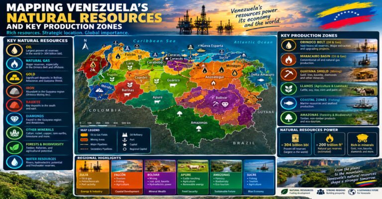
The country’s major petroleum areas include the Maracaibo Basin, the Eastern Venezuela Basin, the Orinoco Oil Belt, and the Barinas Apure Basin. Other areas, including the Falcon Basin and offshore regions, also form part of Venezuela’s wider petroleum geography.
Understanding these regions makes it easier to understand Venezuela’s oil production, its infrastructure, its export system, and the challenges involved in developing its reserves.
Venezuela Oil Regions Mapped Across the Country
Venezuela’s oil geography can be divided into several major areas.
The most important regions include:
- Maracaibo Basin: Located in western Venezuela around Lake Maracaibo, this is one of the country’s oldest and most important oil-producing regions.
- Eastern Venezuela Basin: A very large petroleum system covering much of eastern Venezuela and containing both conventional oil fields and the Orinoco heavy oil accumulation.
- Orinoco Oil Belt: A huge heavy and extra-heavy oil region along the northern side of the Orinoco River.
- Barinas Apure Basin: A smaller oil-producing basin located mainly in western and southwestern Venezuela.
- Falcón Basin: A petroleum-bearing area in northwestern Venezuela with a long connection to the country’s energy industry.
- Offshore regions: Northern and northeastern offshore areas contain petroleum and natural gas resources and are important to Venezuela’s broader energy map.
These regions should not be treated as identical.
A petroleum basin can cover a huge area.
An oil field is a more specific accumulation.
A producing region can contain many oil fields, pipelines, processing plants, and other facilities.
This difference is important when reading an oil map.
What Venezuela Oil Regions Mapped Actually Means
The phrase Venezuela Oil Regions Mapped can describe more than simply placing oil fields on a map.
A useful petroleum map should show several layers of information.
The first layer is geography.
This includes states, cities, rivers, lakes, and major geographic features.
The second layer is geology.
This includes petroleum basins and areas where oil-bearing rocks are found.
The third layer is production.
This shows where wells and fields are producing crude.
The fourth layer is infrastructure.
This includes pipelines, storage facilities, refineries, processing plants, ports, and export terminals.
The fifth layer is data.
This can include production volumes, reserve estimates, crude quality, historical trends, and changes over time.
When these layers are combined, the map becomes a much more useful tool for understanding Venezuela’s oil industry.
Venezuela Oil Regions Mapped by Major Petroleum Basins
Venezuela’s petroleum system is shaped by its geology.
The country’s major basins developed over very long periods as sediments accumulated, organic material was buried, rocks changed under heat and pressure, and hydrocarbons migrated into reservoirs.
The major petroleum regions are therefore connected to geological structures rather than modern political borders alone.
A state boundary tells us where an administrative area begins and ends.
A petroleum basin tells us something about the geological conditions beneath the surface.
These two types of maps overlap, but they are not the same.
This is why one oil field may be close to a state border while the wider petroleum system extends far beyond that border.
The Maracaibo Basin
The Maracaibo Basin is one of the most important oil regions in Venezuela.
It is located in the western part of the country and is closely associated with Lake Maracaibo.
The basin extends across a large area and contains a long history of oil exploration and production.
The region became one of the foundations of Venezuela’s petroleum industry.
For generations, oil activity around Lake Maracaibo supported the development of cities, transportation networks, ports, industrial services, and energy infrastructure.
The basin has also produced very large volumes of conventional oil over its long history.
The Maracaibo Basin is therefore important for two different reasons.
First, it has a major historical role.
Second, it continues to be part of Venezuela’s petroleum production system.
Lake Maracaibo and Venezuela Oil Production
Lake Maracaibo is one of the most recognizable features on any Venezuela Oil Regions Mapped project.
The lake is surrounded by important petroleum areas.
Oil fields have developed along both the eastern and western sides of the lake, while production has also taken place in areas associated with the lake itself.
The petroleum landscape around Lake Maracaibo includes:
- Mature oil fields that have been producing for many decades.
- Pipelines connecting producing areas with processing and storage facilities.
- Ports and terminals supporting the movement of petroleum.
- Industrial centers that developed around the oil industry.
- Roads and other infrastructure created or expanded to support petroleum operations.
The relationship between the lake and the oil industry is especially important because some petroleum infrastructure operates in a challenging water environment.
That makes the Maracaibo region different from inland oil areas.
Major Oil Areas Around Lake Maracaibo
Several well-known oil-producing areas are associated with the Maracaibo petroleum system.
These include:
- Cabimas
- Lagunillas
- Tía Juana
- Bachaquero
- Mene Grande
- Other producing areas throughout Zulia
These locations became closely connected to Venezuela’s early petroleum development.
The region contains many mature fields.
A mature field is not necessarily an exhausted field.
Instead, it means that the field has already experienced substantial exploration and production over a long period.
As a field matures, maintaining production can become more difficult.
Operators may need additional drilling, well work, reservoir management, improved recovery methods, and infrastructure repairs.
Why the Maracaibo Basin Still Matters
The Maracaibo Basin has already produced enormous quantities of oil.
That long history makes it one of the most important petroleum basins in Venezuela.
A modern analysis should not judge the region only by its current production.
Its historical production helped build Venezuela’s petroleum infrastructure and expertise.
The basin also remains important because existing infrastructure can provide a foundation for continued production.
The challenge is that mature petroleum systems often require more work to maintain output.
Older wells may produce less than they did during their early years.
Equipment also needs maintenance.
Pipelines and processing facilities require investment.
These factors can affect the production rate even when substantial petroleum remains underground.
Venezuela Oil Regions Mapped in Zulia
Zulia is central to the western Venezuelan oil story.
The state contains most of the Maracaibo Basin’s Venezuelan portion.
Its petroleum geography includes Lake Maracaibo, major oil fields, pipelines, processing facilities, storage areas, and transportation networks.
Maracaibo city is the largest major urban center in the region.
Other communities, including Cabimas and Lagunillas, developed strong connections with the petroleum economy.
This relationship between oil and urban development is one of the clearest examples of how petroleum can reshape regional geography.
A state-level oil map of Zulia can therefore show much more than oil fields.
It can also show:
- Population centers
- Industrial areas
- Roads
- Ports
- Pipelines
- Refineries
- Storage facilities
- Lake infrastructure
That makes the map useful for both petroleum research and regional economic analysis.
The Eastern Venezuela Basin
The Eastern Venezuela Basin is another major part of the country’s petroleum geography.
It extends across a large portion of eastern Venezuela.
Important areas include:
- Monagas
- Anzoátegui
- Guárico
- Maturín
- Areas extending toward the Orinoco region
The basin contains conventional oil resources as well as the massive heavy oil accumulation of the Orinoco Oil Belt.
This makes eastern Venezuela especially important.
The region combines older conventional petroleum production with one of the world’s largest heavy oil accumulations.
Maturín and the Eastern Oil Region
Maturín is one of the most important petroleum centers in eastern Venezuela.
It is located in Monagas state.
The surrounding region contains many oil fields and energy facilities.
The Maturín area has also been connected to the development of the wider Eastern Venezuela Basin.
Its position makes it important for:
- Oil production
- Petroleum services
- Transportation
- Storage
- Processing
- Regional energy activity
A map of eastern Venezuela should therefore place Maturín alongside the major oil fields and infrastructure.
Monagas and Venezuela Oil Production
Monagas is one of Venezuela’s key oil-producing states.
The state is strongly associated with eastern petroleum production.
Its oil resources include crude from the Eastern Venezuela Basin, with different fields producing different grades.
This is important because Venezuelan crude is not all the same.
Some fields produce lighter or medium crude.
Other areas are dominated by heavy and extra-heavy oil.
The type of crude affects transportation and refining requirements.
Anzoátegui and Petroleum Geography
Anzoátegui is another important eastern oil state.
It has strong links to the Eastern Venezuela petroleum system and the development of the Orinoco region.
The state contains important petroleum infrastructure and has long been connected to the country’s energy economy.
Its geography also makes it relevant to transportation between producing areas and coastal facilities.
The relationship between Anzoátegui and the Orinoco Oil Belt makes the state important when studying Venezuela’s heavy oil development.
Guárico and the Eastern Basin
Guárico is part of the broader Eastern Venezuela petroleum system.
The state occupies an important position between central and eastern Venezuela.
Its petroleum areas are smaller in production than the giant resource concentration farther south and east, but they remain important to the overall basin.
A regional oil map should show Guárico because it helps readers understand the full geographic extent of the Eastern Venezuela Basin.
Venezuela Oil Regions Mapped and the Orinoco Oil Belt
The Orinoco Oil Belt is the most important feature in Venezuela’s modern reserve map.
It is a huge petroleum accumulation located mainly along the northern side of the Orinoco River.
The region is famous for heavy and extra-heavy crude.
The size of its resource base is one of the main reasons Venezuela has such a large proven reserve figure.
Geological assessments have estimated more than one trillion barrels of heavy oil in place across the assessed Orinoco Oil Belt area. A major geological assessment estimated a mean of about 513 billion barrels of technically recoverable heavy oil, with a range of 380 billion to 652 billion barrels.
These figures must be understood correctly.
They do not mean that all of the oil can be produced immediately.
They also do not mean that all of the oil qualifies as proved reserves.
Different petroleum terms describe different stages of resource certainty and economic recoverability.
What Is Oil in Place?
Oil in place means the estimated quantity of oil physically contained within a geological formation.
It is an underground resource estimate.
It does not mean all of that oil can be produced.
Some oil remains trapped in the rock.
Some may be too expensive to recover.
Some may require technology that is not currently practical.
Some may not be commercially recoverable under current economic conditions.
This is why oil in place should never be treated as the same thing as daily production.
What Are Technically Recoverable Resources?
Technically recoverable resources refer to petroleum that could potentially be recovered using existing technology and geological understanding.
This category is broader than proved reserves.
A technical resource estimate asks a geological and engineering question.
It does not necessarily answer whether producing that oil would be profitable under today’s market conditions.
That distinction is particularly important for the Orinoco Oil Belt.
What Are Proven Oil Reserves?
Proven reserves are petroleum quantities that can be recovered with reasonable certainty under defined technical and economic conditions.
This is a narrower category than total resources.
Venezuela’s proven oil reserve figure is therefore not simply the total amount of oil that exists underground.
It represents petroleum classified as reserves under accepted reporting standards.
This distinction makes oil statistics much easier to understand.
Why the Orinoco Oil Belt Is So Important
The Orinoco Oil Belt is important because of its enormous scale.
It represents a huge concentration of petroleum resources in one broad geographic area.
It also represents a challenge.
Much of the oil is very heavy.
Heavy oil does not behave like a light crude.
It can require special production and transportation systems.
The petroleum may need to be:
- Produced using suitable well and reservoir techniques.
- Blended with lighter materials.
- Transported through specialized systems.
- Upgraded before certain uses.
- Processed in refineries capable of handling heavy crude.
This means the Orinoco Oil Belt is not simply a matter of drilling wells.
It is an integrated petroleum system.
Venezuela Oil Regions Mapped by Crude Type
Crude quality is one of the most useful layers to add to an oil map.
A basic map can show where fields are located.
A more advanced map can show the general crude characteristics of those fields.
The main categories are:
- Light crude
- Medium crude
- Heavy crude
- Extra-heavy crude
Venezuela is particularly notable for its heavy and extra-heavy oil.
The Orinoco region contains a very large concentration of this type of petroleum.
Other Venezuelan regions contain a wider mixture of crude qualities.
This difference affects everything from production to refining.
What Makes Heavy Oil Different?
Heavy oil is denser and generally more viscous than lighter crude.
Extra-heavy oil is even more difficult to move.
A simple way to understand the difference is to imagine the physical behavior of liquids.
A lighter crude tends to flow more easily.
A heavy crude moves more slowly and may require additional treatment or blending.
This difference matters in oil production because crude must move from the reservoir to the surface and then through transportation systems.
Why Heavy Oil Affects Production Data
Suppose two regions each contain a very large amount of oil.
If one region contains mostly light crude and the other contains mostly extra-heavy crude, the two regions may not have the same production potential.
The heavy oil region can require:
- More specialized equipment
- More energy
- Additional processing
- Dilution
- Upgrading
- Different transportation systems
This is one reason Venezuela’s reserve numbers should not be compared directly with production numbers from countries with very different crude characteristics.
Venezuela Oil Production Data
Production data provides a second way to understand Venezuela’s oil map.
Reserve data tells us how much petroleum is classified as recoverable.
Production data tells us how much crude is actually being extracted.
Venezuela’s production has changed dramatically over time.
The country once produced several million barrels per day.
Production later fell sharply.
In more recent years, production has recovered from its lowest levels but remains far below the country’s historical peak.
The exact production number depends on the month, reporting organization, and measurement method.
That is why production data should always be tied to a specific time period.
Why Venezuelan Oil Production Declined
The decline in Venezuelan oil production had multiple causes.
It was not caused by one single factor.
The country’s petroleum sector faced a combination of operational, financial, technical, infrastructure, and international challenges.
These included:
- Reduced investment in some periods.
- Maintenance problems.
- Declining output from mature fields.
- Damage or deterioration in some infrastructure.
- Difficulties obtaining equipment.
- Workforce disruptions.
- Refinery and processing constraints.
- International restrictions.
- Problems affecting exports and investment.
- Challenges associated with heavy oil production.
Different analysts have placed different emphasis on these factors.
The important point is that production decline cannot be explained simply by saying that Venezuela ran out of oil.
The country did not run out of oil.
Instead, its ability to produce and move oil was heavily constrained.
Venezuela Oil Regions Mapped and Production Capacity
Production capacity depends on the entire petroleum chain.
A producing field needs wells.
Wells need equipment.
Equipment needs maintenance.
Oil needs gathering systems.
Gathered crude needs transportation.
Transportation requires pipelines, roads, terminals, or other systems.
Heavy crude may require dilution or upgrading.
Refineries need suitable feedstock and functioning equipment.
Exports require storage and terminals.
This means that production capacity is a network.
If one part of the network becomes a bottleneck, total production can be affected.
Oil Fields and Wells Are Not the Same
This distinction is important when reading production data.
A field may contain hundreds or thousands of wells.
Some wells may be producing.
Others may be inactive.
Some may require maintenance.
Some may have low production rates.
A field’s total production therefore depends on the performance of many individual wells.
This is why production data can change even without major changes to the geological resource base.
Venezuela Oil Regions Mapped and Mature Fields
Many Venezuelan oil fields are mature.
A mature field has already experienced long periods of production.
Over time, reservoir pressure can decline.
Water production may increase.
Individual wells can lose productivity.
Older equipment can become less reliable.
Operators can respond with different techniques.
These may include:
- Workovers
- New drilling
- Reservoir pressure support
- Water injection
- Enhanced recovery
- Improved well management
The effectiveness of these methods depends on the specific field.
Maracaibo Basin and Mature Production
The Maracaibo Basin is a good example of a mature petroleum region.
It has been producing for generations.
Its fields have extensive infrastructure.
Its geological systems are well studied.
But mature production brings challenges.
The easiest and most productive parts of a field may have already been developed.
New production may require more advanced techniques.
This can increase the cost and complexity of maintaining output.
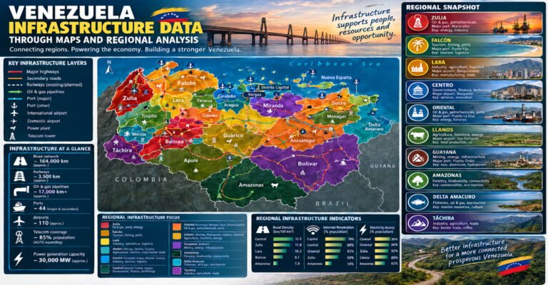
Venezuela Oil Regions Mapped and Infrastructure
A map of oil fields is incomplete without infrastructure.
Venezuela has developed a large petroleum infrastructure network over many decades.
This includes:
- Pipelines
- Gathering systems
- Storage tanks
- Refineries
- Upgraders
- Export terminals
- Ports
- Service bases
- Processing plants
The locations of these facilities are directly connected to the country’s oil geography.
Pipelines in Venezuela’s Oil Industry
Pipelines are essential because oil fields are often located far from refineries and ports.
Pipelines move crude from production areas to processing and export locations.
The main petroleum regions therefore developed networks connecting fields to the wider system.
In western Venezuela, pipelines connect production areas around the Maracaibo Basin with storage, refining, and export facilities.
In eastern Venezuela, pipeline systems connect conventional and heavy oil production with processing and transportation infrastructure.
The pipeline network can therefore be viewed as the physical bridge between geology and markets.
Oil Storage and Production
Storage facilities are another important part of the petroleum system.
Oil production does not always match transportation or export schedules.
Storage can provide flexibility.
It can also help manage changes in production and refinery demand.
For a map-based article, storage facilities should be included because they help explain how crude moves through the system.
Venezuela Refineries and Oil Geography
Refineries are where crude oil is processed into petroleum products.
Venezuela has a large historical refining system.
Important refining centers include:
- Amuay
- Cardón
- Puerto La Cruz
- El Palito
The Paraguana Refining Complex, which includes Amuay and Cardón, is particularly important in the western petroleum system.
Puerto La Cruz is an important refining center in the east.
El Palito is another important refining facility on the central northern coast.
The location of refineries helps explain how crude moves across the country.
Why Refinery Location Matters
Refineries need crude.
Crude needs transportation.
The location of a refinery therefore affects the movement of oil.
A refinery close to major producing areas can reduce some transportation requirements.
A coastal refinery can also have access to maritime trade.
This is why Venezuela’s refining geography should be studied alongside its oil fields.
Venezuela Oil Regions Mapped and Export Terminals
Oil ultimately needs to reach consumers or international markets.
Export terminals therefore form another layer of the map.
A typical export chain looks like this:
- Oil is produced at a field.
- Crude enters a gathering system.
- Pipelines move the crude.
- Storage facilities hold the oil.
- The crude may be processed or blended.
- Tankers load the oil at a terminal.
- The crude is transported to a destination market.
Every step can influence the final amount of oil that reaches the market.
Venezuela Oil Regions Mapped and the Caribbean
Venezuela’s northern coastline gives the country direct access to the Caribbean Sea.
This is important for oil transportation.
Several petroleum facilities and export terminals are located along the northern coast.
The Caribbean location also provides access to international shipping routes.
This makes coastal infrastructure especially important to Venezuela’s petroleum economy.
Venezuela Oil Regions Mapped and International Markets
Venezuelan crude has historically been exported to several international markets.
The destination of Venezuelan crude can change over time because of:
- Market conditions
- Refinery demand
- Shipping arrangements
- International restrictions
- Trade policies
- Commercial agreements
This means an export map should always include the year or period it represents.
A map showing historical destinations should not be presented as a permanent picture of today’s trade.
Venezuela Oil Regions Mapped and Oil Reserves
Reserve geography is different from production geography.
This is one of the most important concepts in the article.
A reserve map may show very large areas of petroleum resources.
A production map may show activity concentrated in fewer areas.
This difference can happen because some resources are difficult to produce.
The Orinoco Oil Belt is the clearest example.
It contains enormous petroleum resources.
But turning those resources into daily production requires extensive infrastructure and technical capability.
Why Venezuela Has Huge Reserves but Lower Production
The simplest explanation is that reserves and production measure different things.
But there is more to it.
Venezuela’s resource base contains a large amount of heavy and extra-heavy oil.
Heavy oil requires more complex handling.
Some conventional fields are mature.
Infrastructure has experienced long-term challenges.
Investment levels have changed.
Production also depends on international economic and political conditions.
Together, these factors explain why the country’s enormous reserve base does not automatically result in enormous daily production.
Venezuela Oil Regions Mapped and the Orinoco Production System
The Orinoco region can be thought of as a production chain.
First, wells produce heavy crude.
Then the crude must be gathered.
The oil may require dilution or other treatment.
It must then move through pipelines or other transportation systems.
Processing and upgrading can change the properties of the crude.
Storage provides another step before refining or export.
This entire chain must function for production to reach the market.
Orinoco Oil Belt Development Areas
The Orinoco Oil Belt has historically been divided into broad development areas.
These include:
- Boyacá
- Junín
- Ayacucho
- Carabobo
These names are useful when studying the geography of heavy oil development.
They should not be confused with Venezuela’s state boundaries.
They are associated with petroleum development areas within the broader Orinoco system.
Venezuela Oil Regions Mapped by Historical Importance
Not every region has played the same role throughout Venezuela’s history.
Western Venezuela was central during the early oil era.
Eastern Venezuela became increasingly important later.
The Orinoco region became increasingly significant because of its enormous heavy oil resources.
This creates a changing petroleum map.
A historical map can therefore look very different from a current production map.
Early Petroleum Development in Western Venezuela
The discovery and development of major oil fields around Lake Maracaibo transformed Venezuela.
The region attracted large investments.
Oil production increased.
Transportation systems expanded.
Ports became more important.
Communities grew.
The country’s economy became increasingly linked to petroleum exports.
The Maracaibo Basin was at the center of this transformation.
Expansion of Eastern Oil Production
As exploration expanded, eastern Venezuela became another major petroleum center.
Fields around Monagas and Anzoátegui became important.
The Eastern Venezuela Basin developed extensive infrastructure.
This expansion helped diversify the geographic base of Venezuelan oil production.
The Rise of the Orinoco Resource Base
The Orinoco Oil Belt was known for its enormous heavy oil accumulation.
As technology and petroleum economics developed, attention increasingly focused on the region.
The belt became a major part of Venezuela’s long-term oil strategy.
Its scale was attractive.
Its crude characteristics created technical challenges.
This combination makes the region one of the most interesting petroleum areas in the world.
Venezuela Oil Regions Mapped and PDVSA
PDVSA is Venezuela’s state-owned oil company.
It has played a central role in the country’s petroleum industry.
Its operations have included:
- Exploration
- Production
- Processing
- Transportation
- Refining
- Marketing
- Exports
Because of its central role, PDVSA’s operating condition is closely connected to national oil production.
Changes in investment, maintenance, staffing, partnerships, and operating policies can affect production across different regions.
Venezuela Oil Regions and Joint Ventures
Venezuela has also used partnerships and joint ventures involving international companies in parts of its petroleum sector.
These arrangements have varied by project and by period.
Joint ventures can be especially important in technically demanding fields.
Heavy oil projects can require:
- Large capital investment
- Advanced technology
- Specialized equipment
- Reservoir expertise
- Processing capacity
The structure of these projects can therefore influence regional production.
Venezuela Oil Regions Mapped and Sanctions
International restrictions have affected Venezuela’s petroleum sector.
These restrictions have changed over time.
They can affect:
- Financing
- Investment
- Equipment access
- Technology
- Partnerships
- Trading arrangements
- Export operations
Because the rules can change, any article discussing current sanctions should identify the specific time period.
For a long-term geographic article, the safer conclusion is that international restrictions have been one of several factors affecting Venezuela’s ability to develop and market petroleum resources.
Venezuela Oil Regions Mapped and Production Recovery
Venezuelan production has shown periods of recovery after reaching very low levels.
However, production recovery should not be confused with a return to historic peak output.
A recovery can occur because:
- Existing wells are repaired.
- New wells are drilled.
- Processing capacity improves.
- Infrastructure is restored.
- Investment increases.
- Export conditions change.
- Operating problems are reduced.
The size of the recovery depends on how many parts of the petroleum system improve at the same time.
Why Monthly Oil Data Can Be Misleading
Monthly production numbers can change quickly.
A temporary pipeline problem can reduce output.
A refinery problem can affect crude demand.
A well repair can temporarily reduce production.
A new drilling program can increase production.
Weather can affect transportation.
Therefore, monthly data should be viewed as part of a trend rather than as a complete picture.
Annual averages are often easier for readers to understand.
Long-term charts are even more useful.
How to Build a Venezuela Oil Production Chart
A strong data article could include several charts.
The first chart could show national crude production over several decades.
The second could show production by broad region.
The third could compare production with proven reserves.
The fourth could show the historical role of the Maracaibo Basin.
The fifth could show changes in eastern production.
The sixth could focus on the Orinoco region.
Each chart should clearly state:
- The year
- The unit
- The source methodology
- Whether the figure is estimated or reported
- Whether it refers to crude oil or total liquids
This prevents readers from comparing numbers that measure different things.
Venezuela Oil Regions Mapped and Data Accuracy
Oil data can be complicated.
Different organizations may publish different production figures.
The differences can result from:
- Different collection methods
- Direct reporting
- Secondary estimates
- Different definitions
- Different measurement dates
- Revisions
A reliable article should not hide these differences.
Instead, readers should be told that production numbers can vary depending on the data series.
Venezuela Oil Regions Mapped and Oil Reserves Data
Reserve data also changes.
Reserve estimates can be revised when:
- New geological information becomes available.
- Production removes oil from existing reserves.
- New fields are discovered.
- Recovery technology improves.
- Economic conditions change.
- Reporting methods change.
Therefore, reserve numbers should always be associated with a year.
A figure from one year should not be presented as if it were permanently unchanged.
Venezuela Oil Regions Mapped and Petroleum Geology
The geology of Venezuela is complex.
The country’s northern margin has been influenced by the interaction of major tectonic plates.
The Caribbean Plate’s movement relative to northern South America helped shape geological structures in the region.
These processes contributed to the formation of sedimentary basins.
Over millions of years, sediments accumulated.
Organic material was buried.
Source rocks matured.
Hydrocarbons formed and migrated.
Reservoirs and traps developed.
This long geological history created the conditions for Venezuela’s major petroleum systems.
Why the Maracaibo Basin Became Oil Rich
The Maracaibo Basin contains the key elements needed for a productive petroleum system.
These include source rocks, reservoirs, seals, and traps.
Its geological structure helped create areas where petroleum could accumulate.
The basin’s long production history demonstrates the effectiveness of this petroleum system.
It has produced enormous volumes of conventional oil.
Why the Eastern Venezuela Basin Became Oil Rich
The Eastern Venezuela Basin developed through a complex geological history.
The basin contains important source rocks and reservoirs.
The Orinoco Oil Belt developed in the southern part of the wider system.
Oil migrated from deeper areas toward shallower parts of the basin.
The resulting accumulation became one of the world’s largest concentrations of heavy oil.
Venezuela Oil Regions Mapped and Oil Migration
Oil does not always remain where it forms.
After hydrocarbons are generated in source rocks, they can migrate through geological formations.
They may move upward or laterally.
If they encounter a suitable reservoir and seal, they can accumulate.
This process helps explain why petroleum accumulations are concentrated in particular geological structures.
It also explains why petroleum basins are so important.
Venezuela Oil Regions Mapped and Reservoir Rocks
Reservoir rocks need space to hold petroleum.
They also need enough connected pore space for oil to move through the rock.
Sandstone is an important reservoir rock in parts of Venezuela’s petroleum systems.
The characteristics of each reservoir affect production.
A reservoir with good permeability may allow oil to flow more easily.
A reservoir with poor connectivity can be more difficult to produce.
This is another reason production varies from field to field.
Venezuela Oil Regions Mapped and Oil Recovery
Only a portion of the oil in a reservoir may ultimately be produced.
The percentage depends on:
- Rock properties
- Oil properties
- Reservoir pressure
- Well design
- Recovery technology
- Water movement
- Economic conditions
Recovery factors can therefore vary widely.
This is another reason why oil in place is not the same as recoverable reserves.
Venezuela Oil Regions Mapped and Enhanced Recovery
Enhanced oil recovery methods can sometimes increase production from mature fields.
Methods can include:
- Water injection
- Gas injection
- Improved reservoir management
- Horizontal drilling
- Other specialized techniques
The appropriate method depends on the reservoir.
A technique that works in one field may not work in another.
This makes field-level geological data important.
Venezuela Oil Regions Mapped and Oil Wells
A well is the connection between the surface and the underground reservoir.
Oil companies use wells to:
- Explore for petroleum
- Confirm discoveries
- Produce oil
- Monitor reservoirs
- Inject water or gas
- Improve recovery
A field can contain many wells.
The number and productivity of those wells affect overall production.
Why Well Count Does Not Equal Production
A region with many wells does not necessarily produce the most oil.
Some wells may be old.
Some may have low flow rates.
Some may be inactive.
Others may produce large volumes.
This is why production data is more useful than well count alone.
A complete map should ideally distinguish between:
- Active wells
- Inactive wells
- Exploration wells
- Injection wells
- Production wells
Venezuela Oil Regions Mapped and Refineries
Venezuela’s refineries form another important geographic network.
The main refining centers have historically included:
- Amuay
- Cardón
- Puerto La Cruz
- El Palito
These facilities are connected to different producing regions.
Their condition and operating capacity can influence how much crude Venezuela can process domestically.
Refining also affects the country’s ability to produce fuels such as gasoline and diesel.
Venezuela Oil Regions Mapped and Fuel Production
Crude oil is not the same as gasoline.
A refinery processes crude into different petroleum products.
These can include:
- Gasoline
- Diesel
- Jet fuel
- Fuel oil
- Liquefied petroleum gases
- Other refined products
The exact output depends on the refinery configuration and the crude being processed.
Heavy crude can require more complex refining systems.
Venezuela Oil Regions Mapped and Export Infrastructure
Venezuela’s export system connects inland producing areas with coastal terminals.
This system includes:
- Pipelines
- Storage
- Ports
- Loading facilities
- Tanker routes
The coastal geography of Venezuela is therefore a major advantage for international oil trade.
However, infrastructure must remain operational for that geographic advantage to translate into exports.
Venezuela Oil Regions Mapped and Ports
Ports are important because crude oil is a global commodity.
Major petroleum ports can handle:
- Crude oil
- Refined products
- Equipment
- Tankers
- Storage operations
The location of these ports can be added to a national petroleum map.
This helps readers understand the final stage of the oil supply chain.
Venezuela Oil Regions Mapped and Economic Impact
Oil has had a major effect on Venezuela’s economy.
Petroleum revenues have influenced:
- Government finances
- Foreign exchange
- Imports
- Infrastructure
- Public spending
- Employment
- Regional development
The effect has been especially strong in oil-producing states.
However, the relationship between oil production and economic growth is not always simple.
High oil production does not automatically create balanced development across every region.
Oil Regions and Local Communities
Oil development can bring employment and infrastructure.
It can also create environmental and social pressures.
Local communities may be affected by:
- Industrial activity
- Traffic
- Pollution risks
- Land use
- Employment changes
- Population movement
The effects differ from region to region.
This is why a people-focused petroleum map should include cities and communities, not just wells and pipelines.
Venezuela Oil Regions Mapped and Population
Population geography matters because oil production occurs near communities.
Zulia contains large urban centers.
Eastern oil regions include cities such as Maturín and Puerto La Cruz.
The Orinoco area includes smaller communities and expanding industrial zones.
A population layer can therefore help explain where petroleum activity intersects with human settlement.
Venezuela Oil Regions Mapped and Agriculture
Some oil-producing regions also contain agricultural land.
This is particularly relevant in parts of the western and eastern interior.
Oil development can compete with other forms of land use.
A detailed regional map can therefore include:
- Oil fields
- Agricultural zones
- Rivers
- Towns
- Protected areas
- Roads
This creates a more complete geographic picture.
Venezuela Oil Regions Mapped and Environmental Risk
Petroleum production carries environmental risks.
These can include:
- Oil spills
- Pipeline leaks
- Produced water
- Waste
- Gas flaring
- Land disturbance
- Refinery emissions
The risk profile can differ between regions.
For example, oil activity around a major lake has different environmental concerns from production in an inland heavy oil area.
Lake Maracaibo Environmental Geography
Lake Maracaibo is especially important because it is both an oil-producing environment and a major water body.
Industrial activity around the lake has created long-term environmental concerns.
Oil infrastructure, urban development, agriculture, and natural systems all overlap.
This makes Lake Maracaibo a useful case study in the relationship between petroleum development and environmental management.
Orinoco Environmental Geography
The Orinoco region presents a different set of environmental considerations.
Large areas contain natural ecosystems, rivers, forests, grasslands, and agricultural land.
Heavy oil development can affect land and water systems.
As production expands or changes, environmental monitoring becomes an important part of responsible resource management.
Venezuela Oil Regions Mapped and Natural Resources
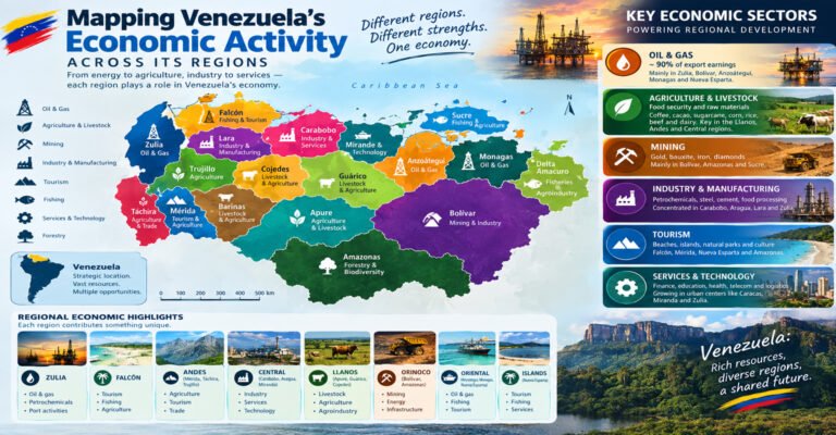
Oil is not Venezuela’s only natural resource.
The country also has:
- Natural gas
- Gold
- Iron ore
- Bauxite
- Coal
- Hydroelectric resources
- Agricultural land
- Forest resources
This matters because petroleum development competes with or interacts with other economic activities.
A natural resource map can therefore show where oil overlaps with other resource areas.
Venezuela Oil Regions Mapped and Natural Gas
Venezuela also has substantial natural gas resources.
Some gas is associated with oil production.
Other gas occurs in separate fields.
Gas infrastructure is connected to the petroleum system in several regions.
This creates another layer that can be added to an energy map.
Venezuela Oil Regions Mapped and Offshore Resources
Venezuela’s petroleum geography extends beyond the mainland.
Offshore areas include the Gulf of Venezuela and other northern and northeastern waters.
Some offshore areas are more significant for natural gas than crude oil.
Offshore development also requires different infrastructure.
This can include:
- Platforms
- Offshore pipelines
- Support vessels
- Coastal processing
- Gas facilities
Venezuela Oil Regions Mapped and the Falcón Basin
The Falcón Basin is located in northwestern Venezuela.
It is smaller than the country’s major petroleum basins but has petroleum significance.
Falcón is also important because of its coastal location and refining infrastructure.
The region demonstrates again that petroleum geography involves more than the location of producing wells.
A region can matter because it contains:
- Refineries
- Ports
- Storage
- Transportation
- Processing infrastructure
Venezuela Oil Regions Mapped and Barinas Apure
The Barinas Apure Basin is located in western and southwestern Venezuela.
It has a smaller petroleum profile than the Maracaibo and Eastern Venezuela basins.
However, it remains an important part of Venezuela’s geological oil map.
Barinas and Apure are also useful examples of how petroleum regions can extend across broad areas with different levels of production.
Comparing Venezuela’s Main Oil Regions
A simple comparison helps organize the country’s petroleum geography.
Maracaibo Basin
The Maracaibo Basin is a mature western petroleum province with a very long production history. Its location around Lake Maracaibo helped create one of Venezuela’s most important historical oil centers.
Eastern Venezuela Basin
The Eastern Venezuela Basin is a large eastern petroleum system containing conventional production and the giant heavy oil accumulation of the Orinoco region.
Orinoco Oil Belt
The Orinoco Oil Belt is the country’s most important heavy oil resource area and is central to Venezuela’s exceptionally large reserve base.
Barinas Apure Basin
The Barinas Apure Basin is a smaller western and southwestern petroleum province with a long history of regional production.
Falcón Basin
The Falcón Basin forms part of Venezuela’s wider petroleum geography and is also connected to important coastal refining and energy infrastructure.
Venezuela Oil Regions Mapped by Production History
Production history can be divided into several broad phases.
The first major phase was the development of western Venezuela.
The second involved the expansion of production into eastern Venezuela.
The third included the growing importance of heavy oil development in the Orinoco region.
The fourth is the modern period, characterized by lower national production than historical peaks, followed by periods of partial recovery.
These phases show why a historical map can be just as useful as a modern map.
Venezuela Oil Regions Mapped and Historical Oil Production
At its historical peak, Venezuela was one of the world’s major crude producers.
The country’s production reached several million barrels per day during strong periods.
The later production collapse was one of the most significant changes in the country’s modern energy history.
The fall was especially important because it occurred despite Venezuela retaining a huge reserve base.
This is one of the clearest examples of the difference between geological wealth and production capacity.
Why Geological Wealth Does Not Guarantee Production
A country needs more than oil underground.
It needs:
- Exploration
- Drilling
- Equipment
- Workers
- Capital
- Roads
- Pipelines
- Storage
- Processing
- Refining
- Export capacity
If any of these areas becomes constrained, production can fall.
This principle applies to Venezuela and to petroleum-producing countries around the world.
Venezuela Oil Regions Mapped and Investment
Investment is particularly important in mature fields.
Existing wells need maintenance.
New wells need drilling.
Pipelines need repairs.
Refineries need upgrades.
Heavy oil facilities require specialized equipment.
Without sufficient investment, production capacity can decline.
When investment increases, output may recover if the geological and infrastructure conditions support it.
Venezuela Oil Regions Mapped and Technology
Technology is another major factor.
Modern oil production uses advanced tools to understand reservoirs and improve recovery.
These can include:
- Seismic surveys
- Horizontal drilling
- Reservoir simulation
- Advanced well logging
- Enhanced recovery methods
- Improved artificial lift
- Heavy oil upgrading
- Pipeline monitoring
Technology cannot remove every geological or economic challenge.
But it can improve the amount of oil that can be recovered from some reservoirs.
Venezuela Oil Regions Mapped and Data Visualization
For a website, this topic works particularly well with visual content.
A strong article can contain:
- A national oil basin map
- A Maracaibo Basin map
- An Orinoco Oil Belt map
- A state-level production map
- A historical production chart
- A reserve comparison chart
- A refinery location map
- A pipeline map
- An oil export route map
These visuals can make complicated information much easier to understand.
How to Design a Venezuela Oil Map
The map should be simple.
Too many labels can make a petroleum map difficult to read.
A good design can use:
- Clear state boundaries
- Major cities only
- Major basins
- Major oil fields
- Simple infrastructure symbols
- A clear legend
- A scale
- A north arrow
Production data can then be represented through graduated symbols or carefully chosen categories.
Venezuela Oil Regions Mapped With Production Categories
A map can divide production into categories rather than showing exact numbers.
For example:
- Very high production
- High production
- Moderate production
- Lower production
- Historical production
- Resource area without major current production
This approach is often easier for general readers.
It also reduces the risk of implying that an exact number is permanent.
How to Compare Oil Regions Fairly
A comparison should use the same measurements for every region.
Useful measurements include:
- Current production
- Historical production
- Proven reserves
- Resource estimates
- Crude quality
- Number of producing fields
- Infrastructure
- Refinery access
A region should not be described as more important simply because it has a larger reserve number.
Another region may have lower reserves but much higher current production.
The metric matters.
Venezuela Oil Regions Mapped and Oil Reserves by Region
Exact reserve figures for individual Venezuelan states can be difficult to compare because public reserve reporting is not always presented in a consistent state-by-state format.
For that reason, broad geological regions are often more useful.
The Orinoco Oil Belt is clearly central to the country’s enormous heavy oil resource base.
The Maracaibo Basin is important because of its extensive historical production.
The Eastern Venezuela Basin contains both conventional resources and heavy oil.
The Barinas Apure Basin represents another petroleum province.
Venezuela Oil Regions Mapped and Current Production
Current production should always be treated as a time-sensitive statistic.
Production can change from month to month.
For a website article, it is better to write:
According to the latest available production data for the stated period…
rather than simply writing:
Venezuela produces X barrels every day.
The first wording recognizes that production changes.
It also allows the article to be updated later.
How to Keep This Article Updated
Because oil production changes, this article should receive periodic updates.
The main sections that may need updates are:
- National production
- Regional production
- Proven reserves
- Refinery operations
- Export data
- Sanctions and international restrictions
- Major infrastructure projects
The geological sections can remain largely evergreen.
This makes the article useful over a long period.
Venezuela Oil Regions Mapped and SEO Search Intent
People searching for this topic may have very different questions.
Some may want a map.
Others may want production data.
Others may want to know where Venezuela’s oil is located.
A strong article should satisfy all of these needs.
It should answer:
- Where is Venezuela’s oil?
- What are the major oil regions?
- What is the Orinoco Oil Belt?
- Where is the Maracaibo Basin?
- How much oil does Venezuela produce?
- Why are Venezuela’s reserves so large?
- Why is production much lower than reserves?
- Which states are associated with oil production?
- What type of crude does Venezuela produce?
This makes the article useful for both search engines and real readers.
Venezuela Oil Regions Mapped and Featured Snippet Questions
Short direct answers are useful for question-based searches.
Where are Venezuela’s main oil regions?
Venezuela’s main petroleum regions include the Maracaibo Basin in the west, the Eastern Venezuela Basin in the east, the Orinoco Oil Belt, and the Barinas Apure Basin.
Where is most of Venezuela’s oil located?
A very large part of Venezuela’s proven oil reserve base is associated with the heavy and extra-heavy petroleum resources of the Orinoco Oil Belt.
What is the Orinoco Oil Belt?
The Orinoco Oil Belt is a huge heavy and extra-heavy oil accumulation located along the northern side of the Orinoco River in eastern and south-central Venezuela.
What is the Maracaibo Basin?
The Maracaibo Basin is a major petroleum basin in western Venezuela centered around Lake Maracaibo and the surrounding Zulia region.
Why does Venezuela have so much oil?
Venezuela contains several highly productive petroleum systems formed through long geological processes involving source rocks, reservoirs, seals, traps, and hydrocarbon migration.
Why does Venezuela produce less oil than its reserves suggest?
Much of Venezuela’s oil is heavy or extra heavy, while some conventional fields are mature. Production is also affected by infrastructure, investment, technology, processing capacity, operating conditions, and international market restrictions.
Venezuela Oil Regions Mapped and the Future of Production
Venezuela’s future oil production will depend on how effectively the country can develop its existing resources.
The resource base is enormous.
But the production system needs investment and functioning infrastructure.
The most important opportunities are likely to involve both mature conventional fields and the heavy oil resources of the Orinoco region.
Mature fields may benefit from improved recovery methods.
The Orinoco region may benefit from better production and upgrading technology.
Both require functioning transportation and processing systems.
Future Development of the Orinoco Region
The Orinoco Oil Belt is likely to remain central to discussions about Venezuela’s petroleum future because of its scale.
Its development depends on several connected factors.
These include:
- Investment
- Production technology
- Upgrading capacity
- Pipeline availability
- Skilled labor
- Refinery compatibility
- Export infrastructure
- International commercial conditions
The enormous resource base provides an opportunity, but converting that resource into sustained production requires a functioning industrial system.
Future Development of the Maracaibo Basin
The Maracaibo Basin has a different future challenge.
It is a mature petroleum province.
Future development may focus more on maintaining and improving existing production.
Possible approaches include:
- Workovers
- New drilling
- Enhanced recovery
- Better reservoir management
- Infrastructure rehabilitation
- Modern production technology
Because the basin already has extensive infrastructure, its future development can benefit from the existing petroleum network.
Future Development of Eastern Venezuela
Eastern Venezuela combines several types of petroleum opportunity.
The region has conventional fields.
It also contains the Orinoco heavy oil system.
This creates a diverse production base.
The future of the region will depend on which projects receive investment and how infrastructure develops.
Venezuela Oil Regions Mapped and Energy Security
Venezuela’s oil geography also matters for energy security.
A country with large domestic oil resources can potentially produce enough crude for domestic consumption and export.
However, this depends on refining capacity.
Crude oil must be converted into usable fuels.
If refineries are not operating properly, a country can experience fuel shortages even when it has large crude reserves.
This is another reason why oil maps should include refineries.
Crude Oil and Fuel Are Different
A common misunderstanding is that having crude oil automatically means having gasoline.
It does not.
Crude oil must be processed.
Refineries separate and transform crude into different products.
A country can therefore have enormous crude reserves while still facing challenges with fuel supply.
This distinction is especially important when discussing Venezuela.
Venezuela Oil Regions Mapped and Transportation
Transportation links the oil-producing regions to the rest of the economy.
Roads support oil field operations.
Pipelines move crude.
Ports handle exports.
Rail and road networks can move equipment and supplies.
Airports can support workers and technical teams.
These systems together form the physical infrastructure of the petroleum industry.
Venezuela Oil Regions Mapped and Economic Hubs
Several Venezuelan cities have strong connections with the petroleum sector.
These include:
- Maracaibo
- Cabimas
- Maturín
- Puerto La Cruz
- Punto Fijo
- Barcelona
- Other cities near oil fields and energy infrastructure
Each city has a different role.
Some are production centers.
Some are refining centers.
Some provide services.
Some are transportation hubs.
This makes urban geography an important part of petroleum mapping.
Venezuela Oil Regions Mapped and Oil Service Industry
Oil production depends on a large support industry.
Companies and workers provide:
- Drilling services
- Equipment maintenance
- Engineering
- Transportation
- Geological analysis
- Construction
- Environmental services
- Logistics
- Well services
Oil regions can therefore have economic activity far beyond the wellhead.
This is one reason petroleum production has such a large regional economic impact.
Venezuela Oil Regions Mapped and Employment
The petroleum industry creates direct and indirect employment.
Direct jobs include:
- Engineers
- Geologists
- Drillers
- Technicians
- Refinery workers
- Pipeline workers
Indirect jobs can include:
- Transportation
- Construction
- Food services
- Equipment supply
- Maintenance
- Security
- Logistics
The size of this employment network can change when production rises or falls.
Venezuela Oil Regions Mapped and Regional Inequality
Oil development can produce large economic benefits in some areas while leaving other regions less connected to the petroleum economy.
This can create differences between oil-producing and non-oil-producing regions.
A regional data project can compare:
- Oil production
- Population
- Employment
- Infrastructure
- Economic activity
- Government revenue
Such comparisons help readers understand the wider effects of petroleum geography.
Venezuela Oil Regions Mapped and Government Revenue
Oil has historically been a major source of government income and foreign exchange for Venezuela.
When production and exports fall, government revenue can also be affected.
When production and oil prices rise, petroleum revenue can increase.
This relationship is one reason production data matters beyond the energy sector.
Venezuela Oil Regions Mapped and Exports
Oil exports connect Venezuela’s domestic geography with the international economy.
Production areas are connected to:
- Pipelines
- Storage
- Ports
- Tankers
- International refineries
The export network can therefore be mapped as a series of connected points.
A simple export map might show the journey from the Orinoco region to a coastal terminal.
Another might show the movement of crude from western Venezuela to a refining or export center.
Venezuela Oil Regions Mapped and Oil Markets
Venezuelan crude competes in a global market.
The price and demand for different crude grades can change.
Heavy crude may be especially attractive to refineries designed to process it.
This means Venezuela’s crude quality influences where its oil can be sold efficiently.
The global refining system therefore affects Venezuela’s regional petroleum economy.
Venezuela Oil Regions Mapped and Heavy Crude Markets
Heavy crude requires suitable refining capacity.
A refinery configured to handle heavy oil can be better suited to Venezuelan crude than a refinery designed mainly for light crude.
This is one reason Venezuelan oil exports have historically been linked to particular refinery systems and markets.
It also explains why crude quality should be included in petroleum maps.
Venezuela Oil Regions Mapped and Production Challenges
The major challenges facing Venezuelan oil production can be grouped into several categories.
Geological challenges
Some reservoirs are mature or technically difficult.
Crude quality challenges
Much of the resource base consists of heavy and extra-heavy crude.
Infrastructure challenges
Pipelines, refineries, storage systems, and other facilities require maintenance.
Investment challenges
Large production increases require capital.
Technical challenges
Heavy oil and mature fields require specialized knowledge.
Market challenges
Crude prices and refinery demand affect project economics.
International challenges
Restrictions and commercial conditions can affect trade and investment.
These factors interact with each other.
Venezuela Oil Regions Mapped and Data Interpretation
Readers should be careful when comparing different statistics.
For example:
303 billion barrels of reserves
and
less than one million barrels per day of production
are not contradictory.
The first number describes a stock of petroleum reserves.
The second describes a flow of petroleum production.
The two measurements use different units and answer different questions.
Stock Versus Flow in Oil Data
A simple example can help.
Imagine a tank contains 1,000 liters of water.
If you use 10 liters per day, the tank contains a large stock but has a small daily flow.
Oil reserves are similar to the amount in the tank.
Production is similar to the amount flowing out each day.
The size of the tank does not automatically tell you how fast the liquid can flow.
This is exactly why Venezuela’s enormous reserves should not be interpreted as proof of equally enormous current production.
Venezuela Oil Regions Mapped and Oil in Place
The same idea applies to oil in place.
Oil in place can be enormous.
But recovery is limited by:
- Rock properties
- Oil properties
- Technology
- Economics
- Infrastructure
Therefore:
Oil in place is not production.
Resources are not reserves.
Reserves are not daily output.
Keeping these distinctions clear is essential for accurate oil reporting.
Venezuela Oil Regions Mapped and the Role of Geography
Geography influences every stage of the oil industry.
The location of the field affects:
- Transportation distance
- Pipeline routes
- Access to ports
- Access to workers
- Environmental conditions
- Infrastructure costs
The location of the refinery affects:
- Crude transportation
- Fuel distribution
- Export options
The location of the port affects:
- Shipping routes
- Storage
- Export logistics
This is why petroleum is fundamentally a geographic industry.
Venezuela Oil Regions Mapped and Regional Infrastructure
The country’s infrastructure network has developed over many decades.
Some facilities were built during earlier production periods.
Others were added as new regions became important.
The result is a complex network connecting different generations of petroleum infrastructure.
A map can show how this network evolved.
Historical maps can reveal how production moved from one region to another over time.
Venezuela Oil Regions Mapped and Historical Maps
Historical maps are useful because they show changes in petroleum development.
A historical map could show:
- Early oil fields
- Historic pipelines
- Former production centers
- Refinery development
- Expansion of eastern production
- Growth of Orinoco projects
Comparing historical and modern maps can show how Venezuela’s oil geography has changed.
Venezuela Oil Regions Mapped and Modern Data
A modern map should ideally use recent information.
However, geological boundaries do not change quickly.
A basin remains a basin.
An oil field’s location remains the same.
Production figures can change rapidly.
Therefore, maps and data should be treated differently.
The map can remain useful for years.
The production numbers should be updated more often.
How Often Should Production Data Be Updated?
For a website that wants to remain current, national production data can be reviewed monthly or quarterly.
Reserve data can be reviewed annually.
Infrastructure changes can be updated when major developments occur.
Geological descriptions usually need less frequent updates.
This approach keeps the article useful without requiring constant rewriting.
Venezuela Oil Regions Mapped and Reader Takeaways
After reading this article, readers should understand several basic ideas.
First, Venezuelan oil is concentrated in major geological regions.
Second, the Maracaibo Basin is the major western petroleum system.
Third, the Eastern Venezuela Basin is one of the country’s largest petroleum systems.
Fourth, the Orinoco Oil Belt contains an enormous amount of heavy and extra-heavy oil.
Fifth, the Barinas Apure Basin is another producing petroleum province.
Sixth, reserves are not the same as production.
Seventh, infrastructure is essential for turning petroleum resources into actual production.
Eighth, crude quality affects transportation and refining.
Ninth, production changes over time.
Tenth, maps become much more useful when combined with production data.
Frequently Asked Questions About Venezuela Oil Regions Mapped
Where are Venezuela’s biggest oil regions?
The most important petroleum regions are the Maracaibo Basin in western Venezuela, the Eastern Venezuela Basin in the east, and the Orinoco Oil Belt associated with the eastern basin. The Barinas Apure Basin is another producing region.
What is the biggest oil region in Venezuela?
The Orinoco Oil Belt is the country’s largest major heavy oil resource area and is central to Venezuela’s exceptionally large reserve base.
Where is the Maracaibo Basin?
The Maracaibo Basin is located in western Venezuela around Lake Maracaibo, mainly in and around Zulia state.
What state has the most important historic oil fields?
Zulia is closely associated with Venezuela’s historic oil industry because of the Maracaibo Basin and the major producing areas around Lake Maracaibo.
Where is the Orinoco Oil Belt located?
The Orinoco Oil Belt stretches across a broad area along the northern side of the Orinoco River in eastern and south-central Venezuela.
What kind of oil does Venezuela have?
Venezuela produces several crude grades, but a very large part of its reserve base consists of heavy and extra-heavy crude, especially in the Orinoco region.
Why is Venezuelan oil called heavy?
Heavy crude has a higher density and generally greater viscosity than lighter crude. Much of the petroleum in the Orinoco region is very heavy and requires specialized production and processing systems.
Does Venezuela have more oil than it produces?
Yes. Venezuela’s proven reserves are extremely large compared with its current daily production. This difference reflects the distinction between underground reserves and the ability to produce oil at a particular rate.
Why doesn’t Venezuela produce all of its oil reserves?
Not all reserves can be produced at once. Production depends on wells, reservoir conditions, infrastructure, investment, technology, processing capacity, transportation, and market conditions.
Is the Orinoco Oil Belt an oil field?
No. It is a huge petroleum accumulation and development region containing many oil fields within the broader Eastern Venezuela petroleum system.
What is the Maracaibo Basin known for?
The Maracaibo Basin is known for its long history of oil production and its large conventional petroleum fields around Lake Maracaibo.
What are the main oil states in Venezuela?
Important oil-producing areas include Zulia, Monagas, Anzoátegui, and parts of Guárico, Barinas, and Apure.
What is the Barinas Apure Basin?
It is a petroleum basin located in western and southwestern Venezuela that contains oil fields and has a long history of regional production.
Does Venezuela produce light oil?
Yes. Venezuela produces different crude grades, although heavy and extra-heavy crude make up a major part of its enormous resource and reserve base.
How does Venezuela transport its oil?
Crude is moved through gathering systems, pipelines, storage facilities, processing and upgrading systems, and coastal export terminals.
Why are pipelines important to Venezuela’s oil industry?
Pipelines connect producing fields with storage, processing facilities, refineries, and export terminals. Without reliable transportation, production may not be able to reach consumers or international markets efficiently.
What are Venezuela’s main refineries?
Major refining centers have included Amuay, Cardón, Puerto La Cruz, and El Palito.
What is PDVSA?
PDVSA is Venezuela’s state-owned petroleum company and has historically played a central role in exploration, production, refining, transportation, and petroleum exports.
Why is Lake Maracaibo important to oil production?
Lake Maracaibo is surrounded by the Maracaibo Basin, one of Venezuela’s most important petroleum provinces. The region contains many mature oil fields and extensive petroleum infrastructure.
Why is Venezuela important to the global oil market?
Venezuela has an exceptionally large crude oil reserve base and one of the world’s largest concentrations of heavy oil resources. Its production and export capacity therefore have significance beyond the country itself.
Venezuela Oil Regions Mapped provides a clearer way to understand one of the world’s most unusual petroleum landscapes.
The country does not have one single oil region.
It has several major petroleum systems with different geological histories, crude characteristics, production records, and infrastructure networks.
The Maracaibo Basin represents the historic center of western Venezuelan oil production.
The Eastern Venezuela Basin forms one of the country’s major petroleum systems and includes important producing areas in Monagas, Anzoátegui, and Guárico.
The Orinoco Oil Belt represents the enormous heavy and extra-heavy petroleum resource that gives Venezuela its exceptional reserve position.
The Barinas Apure Basin adds another petroleum province in the west and southwest.
These regions tell different parts of the same story.
Maracaibo shows the importance of mature conventional production.
Eastern Venezuela shows the importance of a large and diverse petroleum basin.
The Orinoco region shows the enormous scale of Venezuela’s heavy oil resources.
Barinas Apure shows that Venezuela’s petroleum geography extends beyond its two largest systems.
Production data adds another layer.
It shows that the amount of oil underground is not the same as the amount of oil being produced.
This is perhaps the most important fact for anyone studying Venezuela’s energy sector.
The country can have enormous reserves while producing much less than those reserves might suggest.
The reasons include crude quality, mature fields, infrastructure, investment, technology, processing capacity, transportation, and changing international conditions.
A useful Venezuela Oil Regions Mapped resource should therefore combine geography with data.
It should show where the major basins are.
It should identify the major producing areas.
It should explain the difference between conventional and extra-heavy crude.
It should show how pipelines and refineries connect producing regions to markets.
It should separate reserves from resources and production.
It should also make clear that production numbers belong to specific periods and can change.
The result is a much more accurate picture of Venezuela’s petroleum industry.
The map shows where the oil is.
The geological data helps explain why it is there.
The production data shows how much is being produced.
The infrastructure map explains how the oil moves.
Together, these four elements provide a complete way to understand Venezuela’s oil geography and the production system built around it.